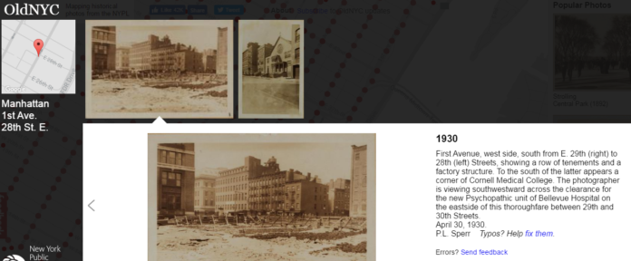
This guy used over 80,000 old photos to create a Google Street map of New York City in the 1800s

0
945

It is nearly impossible to look at today’s New York city and tell what it used to look like, though NY has  a long and extensive history. Thanks to this enterprising coder now this problem is solved.

Developer Dan Vanderkam has created a Google Street View map for New York City for the lte 1800s and erly 1900s.

Dan in collaboration with New York Public Library has plotted old photos from the Photographic Views of New York City, 1870s-1970s collection on an interactive map.


Central Park, showing the pond at 110th Street and the Botanical Gardens, 1906, Image courtesy: New York Public Library
Nassau Street and Wall Street (showing the under-construction Bankers Trust Building and the Hanover National Bank Building), 1911, Image courtesy: New York Public Library
Nassau Street and Wall Street (showing the under-construction Bankers Trust Building and the Hanover National Bank Building), 1911, Image courtesy:
New York Public Library
Wall Street and Nassau Street (statue of George Washington), 1900, Image courtesy: New York Public Library
Brooklyn Bridge, 1873, Image courtesy: New York Public Library

Visit the OldNYC site here for more of the best photos from the late 1800s and early 1900s, marked with their locations in the city.

Sourced from Tech Insider, Featured image courtesy: oldnyc.org

LEAVE A REPLY